It is not so easy for a yacht. Even where there are occasional ranges to be had, they cannot be used to work out all twelve bearings you need for a usable deviation card.
For most of us, it means that we have never even SEEN a deviation card on a yacht, much less have one for our own. However, a sun compass is an easy-to-build instrument that will let you swing your compass in the space of an hour.
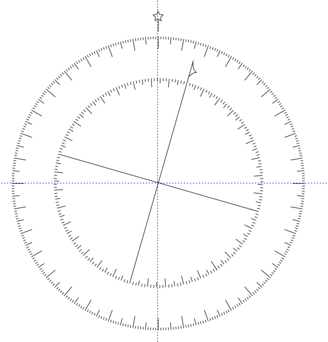
Step 1: Construct a sun compass for the latitude where you plan to do your testing
Click here for instruction on construction.
Step 2: Determine the magnetic variation for the location where you will do your testing
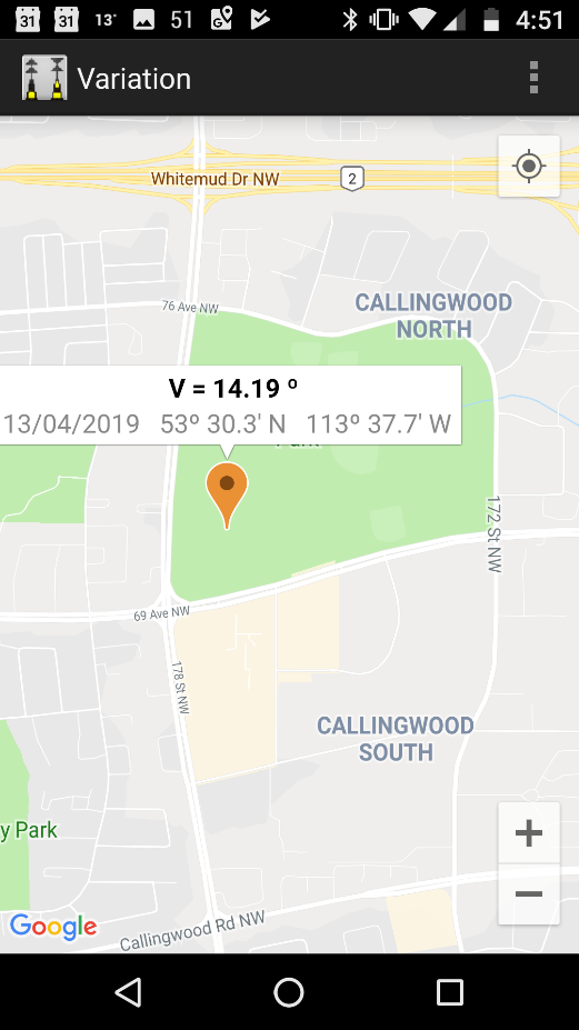
Go to www.geomag.nrcan.gc.ca/calc/mdcal-en.php to calculate your magnetic variation.
So if you are going to do your testing in Stuart Channel, just to the west of Thetis Island, BC, you will observe that your variation is 16° east (as of April, 2019).
If you find it easy to use an acronym like "True Virgins Make Dull Companions Saturday Evening" (True ± Variation = Magnetic ± Deviation = Compass (subtract east)", then go right ahead. I find it easier, at least initially, to keep track by sketching diagrams for myself.
Step 3: Determine Influence of Engine Running
While tied up at the dock, turn on all of the electronics you normally use while under way. Observe the reading your steering compass gives you.
Turn on the engine. Observe if the steering compass changes bearing.
Move your vessel out of its slip and tie it up at the end of the dock, so the boat is now at 90° to where it was before. Rerun your test with engine on or off.
If there is no difference in how your steering compass reads with engine on compared to engine off, then your job is simple. You can go out and steer along specified bearings with the sails down. If conditions are relatively smooth, you can probably swing your compass in the space of an hour.
If, however, the readings change with engine on vs. engine off, then you are going to have to develop two deviation cards...one for engine on, and a second card for sailing with the engine off.
Step 4: Determine deviation for a course of 000° Magnetic
Assuming you are in Stuart Channel, west of Thetis Island, line up your vessel steady on a course so that your steering compass reads 000°.
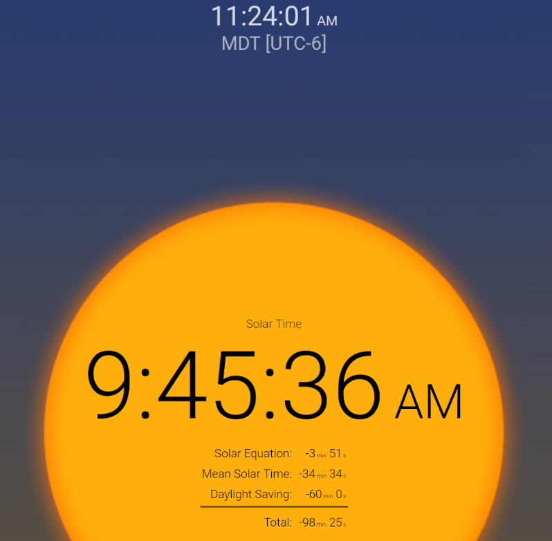
Line up your sun compass to local solar time, using a app such as "Solar Time" for Android. It makes the conversion easy, as it uses your phone's GPS to determine your Δ longitude from the zone time central meridian, which this app calls "Mean Solar Time" correction. Further, it uses the calendar on your phone to calculate the Equation of Time, which it calls the "Solar Equation". (If you don't know what these corrections are, don't worry. Just read what the app tells you is the solar time. This is what your sun compass displays.)
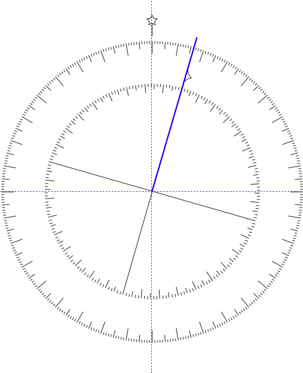
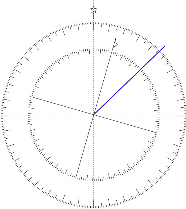
Line up the pointer of your sun compass so that it is parallel with the centerline of your vessel. If you have zero deviation, then the boat should be on a course of 016° True, which is 000° Magnetic.
If the sun compass reads 018°, then you know you would need to turn left by 002° to bring your course to 016° True. That is, you need to subtract 2° to line up on precisely 000° Magnetic.
So write this down:
For 000°
Steer -2
Step 5: Determine deviation for a course of 030° Magnetic
Line up your vessel steady on a course so that your steering compass reads 030°.
Line up your sun compass to local solar time.
Line up the pointer of your sun compass so that it is parallel with the centerline of your vessel. If you have zero deviation, then the boat should be on a course of 046° True, which is 030° Magnetic.
If the sun compass reads 044°, then you know you would need to turn right by 002° to bring your course to 046° . That is, you need to add 2° to line up on precisely 030° Magnetic.
So write this down:
For 000° 030°
Steer -2 +2
Step 6: Rerun procedure for True courses of 30°, 60°, etc. on up to 330°
For 000° 030° 060° 090° 120° 150°
Steer -2 +2For 180° 210° 240° 270° 300° 330°
Steer
Step 7: Create your deviation card
The website you used in Step 2 above, www.geomag.nrcan.gc.ca/calc/mdcal-en.php, tells you that the variation in the Gulf Islands is changing by 9.2' per year. Because of the dynamic way that variation interacts with the local magnetic fields on your boat, you should rerun this procedure every five years or so...so be sure to indicate the date on your deviation card.
Recreating a deviation card at intervals is important not only because variation is changing, but the rate at which variation changes across the earth is unpredictable. If you have a deviation card that is 10 years old, you don't know how wrong it is...but it is guaranteed to BE wrong.
And of course, you should rerun this procedure if you install new electronics, or swap out your engine.
If you know the local solar time, a sun compass is as accurate as any handmade navigational instrument can be. To make use of that accuracy, you should make your sun compass for the precise latitude where you expect to be swinging your compass. That is, if you are picking up a new boat in Brest, France, and plan to swing your compass in the Baie de Douarnenez, then make yourself a sun compass for 48.1° of latitude.
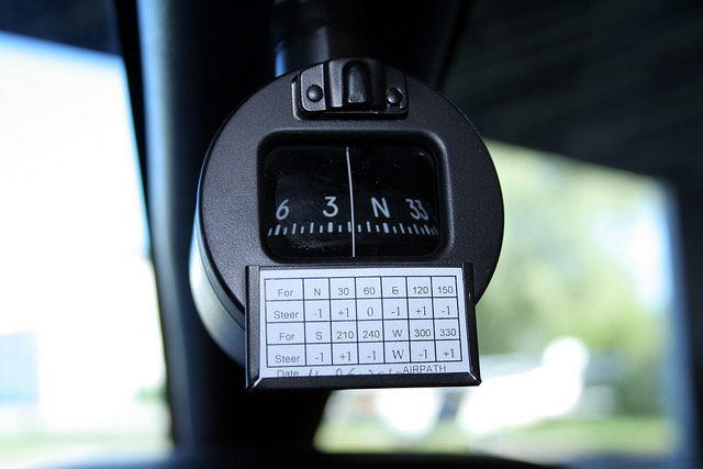
I personally like this style of deviation card:
With this, I estimate in my head what the correction should be for intermediate directions. But you may prefer to make this sort of deviation card for yourself:
Deviation of up to 10° is generally treated as acceptable. If you have deviation greater than 10°, you may want to have a professional compass adjuster come and tinker with your steering compass.