Table of Contents
Class Prep
Class 1
Class 2
Class 3
Class 4
Class 5
Class 6
Class 7
Class 8
Class 9
Class 10
>>Topical Articles<<
Assumed Longitude
Bowditch
Bygrave
Casio fx-260 Solar II
Emergency Navigation
Making a Kamal
Noon Sight
Pub. 249 Vol. 1
Sextant Adjustment
Sextant Skills
Sight Averaging
Sight Planning,
Error Ellipses,
& Cocked Hats
Slide Rules
Standard Terminology
Star Chart
The Raft Book
Time
Worksheet Logic
BCOSA.ca
In 1802, a navigation handbook, written by Nathaniel Bowditch, was released as The American Practical Navigator. Bowditch continued to revise the work and republish it for the next several decades until his death. Eventually, the copyright was purchased by the U.S. Government, and it continues to be published today.
The 2019 edition of Bowditch (as it is known) has just been released, and is available at https://msi.nga.mil/NGAPortal/MSI.portal?_nfpb=true&_pageLabel=msi_portal_page_62&pubCode=0002
If the Bowditch download site does not load, try again later. They seem to be under a more-or-less constant denial-of-service attack by hackers.
Alternatively, you can go to http://fer3.com/arc/navbooks2.html and download the 2002 edition.
It is an encyclopedia of navigational knowledge, and — particularly as it may be had at no charge — is well worth downloading. Some parts, for instance §811 on degaussing a steel vessel to reduce the risk from magnetic mines, are clearly more relevant to large vessels, even naval vessels. Still, there is much that is worthwhile for the small boat sailor. If you go to §1336, for instance, you will see where Bob got his star charts from.
It may be that Celestaire or some other firm will download The American Practical Navigator and publish it as a bound volume (much as companies have done for Pub. 249), but this has not happened yet. For now, the only way to get Bowditch is as a downloaded PDF file.
While you are at this web page, you might find something else you are interested in, for instance Chart 1.
Uses For Bowditch
I am not sure how influential Bowditch is in other parts of the English-speaking world, but in the US and Canada, at least, it is the go-to resource for navigators. For instance, when Bob was researching navigation in the Canadian North, on behalf of Carly and her "Project S", Bowditch was where he started.
It has some characteristics that limit its usefulness for the small boat sailor. For instance, it assumes that you will do your sight reduction using either Pub. 229 (which few small boat sailors use) or STELLA (a software program which every ship in the US Navy has but is not available at all for civilian users).
Still, there are aspects of it — particularly in Volume 2 — that could make it worthwhile to have on the little bookshelf in your yacht. For instance,
- Table 12 - Distance of the Horizon.
- Table 13 - Geographic Range
- Table 15 - Distance by Vertical Angle Measured Between Sea Horizon and Top of Object Beyond Sea Horizon
- Table 18 - Distance of an Object by Two Bearings
Table 14 is also of use to the ocean navigator who wants to take a sextant shot but finds that there is a container ship, or a small island, just beneath the celestial object he wants to shoot.
Appendix A in Volume 2 is definitely aimed at the sailor, as it indicates traditional world sailing routes, based on prevaling winds and currents.
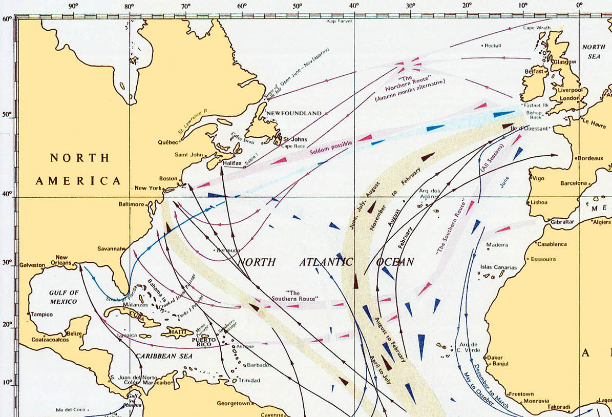
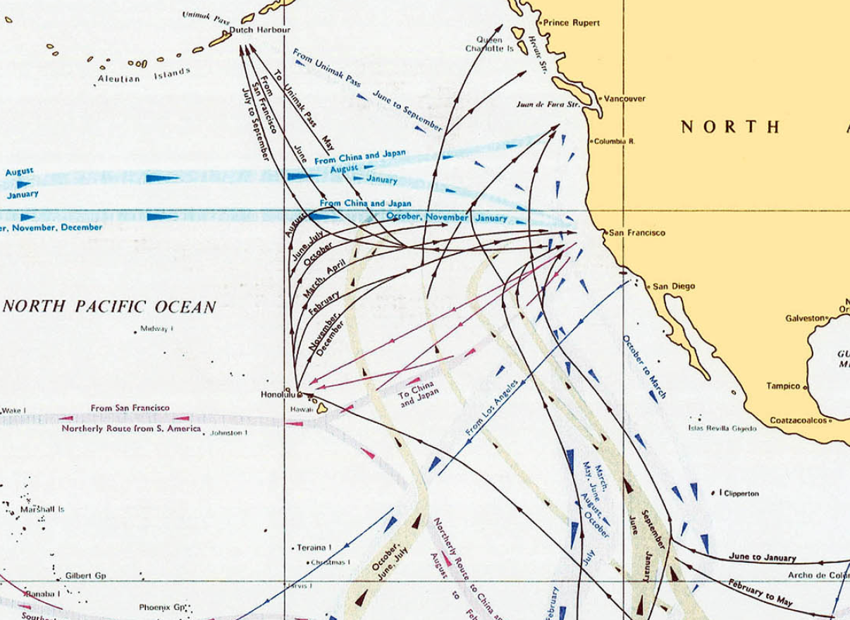
Even if one will never travel these routes, it brightens a cold winter day in Canada to stare at this chart and dream.