Table of Contents
Class Prep
Class 1
Class 2
Class 3
Class 4
Class 5
Class 6
Class 7
Class 8
Class 9
Class 10
>>Topical Articles<<
Assumed Longitude
Bowditch
Bygrave
Casio fx-260 Solar II
Emergency Navigation
Making a Kamal
Noon Sight
Pub. 249 Vol. 1
Sextant Adjustment
Sextant Skills
Sight Averaging
Sight Planning,
Error Ellipses,
& Cocked Hats
Slide Rules
Standard Terminology
Star Chart
The Raft Book
Time
Worksheet Logic
BCOSA.ca
New/Changed Pages in This Web Since Last Week
- Casio fx-260 Solar II
- Pre-Class Prep
- Sight Averaging
Class Plan
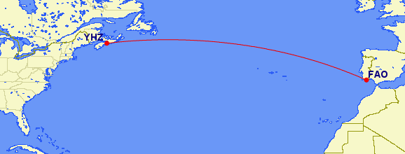
If the Bowditch download site does not load, try again later. They seem to be under a more-or-less constant denial-of-service attack by hackers. Alternatively, you can go to http://fer3.com/arc/navbooks2.html and download the 2002
edition. The direct-calculation equation is found in section 2202. If you are using the do-it-yourself tool, HERE is the kind of
output it gives based on a trip that departs Cape St. Vincent at 10 AM on Sept. 12.
Because of the uncertainty in weather forecasts, it does not give a detailed projection for the whole trip. It assumes you
will reconnect to the server via your on-board Internet connection, and refresh the route plan.
Halifax is the best place to make your initial landfall in N. America.
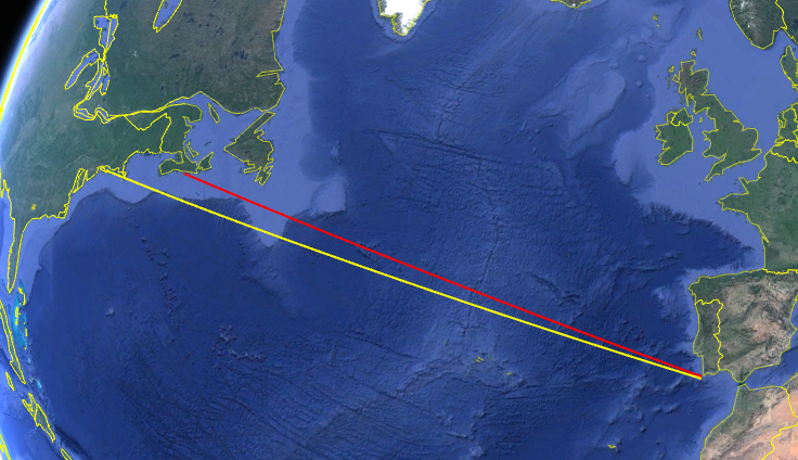
From:
36° 54.6' N
9° 12.5' W
to...
63° 34.4' W
Reduce the moon sight using the Mark 1 Navigator's Slide Rule.
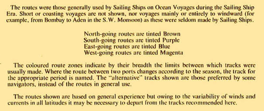
Pilot charts have been evolved based on the experience of sailors over a period of centuries. However, global warming is producing changes in the long term patterns of wind and weather. Cornell's
book is an attempt to take these changes into account.
Though expensive, you might find Jimmy Cornell's World Cruising Super Pack a worthwhile investment before crossing an ocean.
Another alternative is a do-it-yourself weather routing tool like this.
In this case, if the weather lives up to the forecast, you can make the journey in 13 days 15 hours.
Materials Required
Homework Assignment